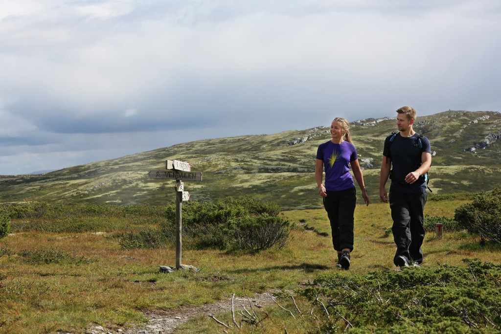
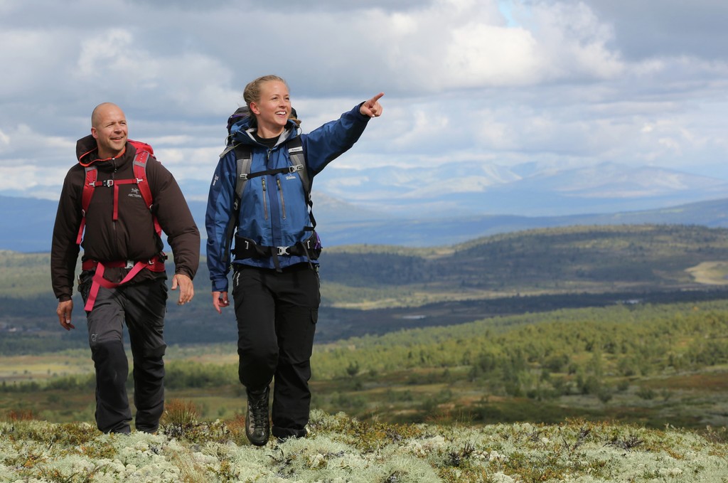
Walking the trails of Kvitfjell
In Kvitfjell and the surrounding area there is a lot of nice hiking terrain in great nature, suitable for everyone. Along the Peer Gynt trail there are many opportunities for short or long trips, if you do not want to try the whole trip which is 90 km. See map further down and description.
Peer Gynt trail
The easily accessible nature of Peer Gynts Rike invites active use, and has a wealth of well-marked hiking trails in varied terrain. Many of the trails go in high mountain terrain and have views of Jotunheimen, Rondane and Huldreheimen, while other trails go in forest terrain with birch, spruce or pine. The area has a rich and exciting flora and fauna, and many good fishing waters. The destinations are linked by the Peer Gynt Path, which provides excellent opportunities for going from place to place through the Kingdom of Peer Gynt.
The Peer Gynt trail passes through the mountain terrain on the west side of Gudbrandsdalen in the Peer Gynt kingdom, which forms the eastern part of Huldreheimen.
The model of Ibsen's Peer Gynt was a real person who lived in the Sødorp village near Vinstra. He has given names to this mountain range that extends from Gausdal and Skeikampen in the south and Skåbu and Espedalen in the north and west. Through this beautiful and varied mountain terrain, the approximately 90 km long Peer Gynt trail passes through many hotels and mountain lodges along the way, making accommodation and dining easy.
In winter, Peer Gynt runs through the same area.
Starting points
The Peer Gynt Trail can be walked in either direction, and it is possible to start the hike anywhere along the way and walk parts of the trail. In Kvitfjell, the Peer Gynt trail starts out from the parking area on the west side of Gudbrandsgard Hotel. Towards Skardbua and Skeikampen, the service road in the resort is followed southwest up the slope and then on a trail on the east side of the actual Kvitfjellet. Against Vendalen and Fagerhøi, the trail follows the ski trail path northwest and up the slope towards Hestknappen.
The terrain
The mountain area of Peer Gynts Rike is a great hiking area. Most of the time the route goes at 900 - 1,000 meters altitude, but the Peer Gynt trail also goes up to 1,500 m.h. On large parts of the route there is a nice view to Rondane and Jotunheimen. The terrain is varying high mountain terrain, mainly with a mixture of snowy mountains and high mountain birch forest. The route generally follows good paths and seat roads and has no very demanding or airy passages. Still, good footwear (hiking shoes or similar) is recommended, and clothing that can withstand both wind and a rain shower.
Signs / Labeling
The trail is marked with DNT's red T's and is marked in all intersections with the text Peer Gynt trail and current place names. In addition, small arrow signs with a walking symbol are used, otherwise there may be doubts about the direction. Where the path is clear and easy to follow, there may be up to 100 m between the marks / paint marks. Where there is less clear path, there may be marks as close as 5 - 10m.
Map
Maps should be used on the trip. Here the tour map Peer Gynts Rike is recommended. (Order # 2563 from Ugland IT). On this map, the Peer Gynt trail is drawn.
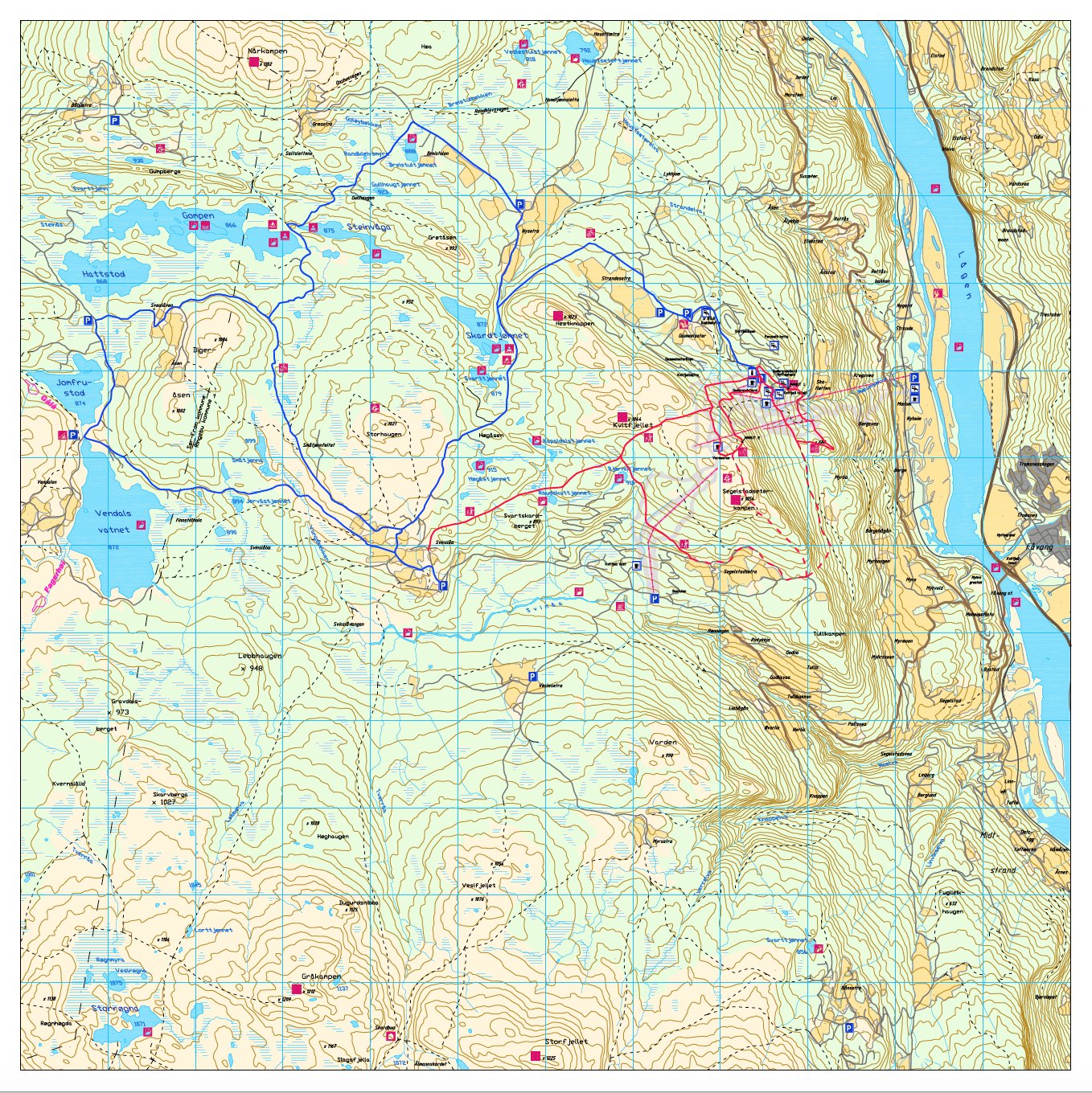 At UT.no you can find several other suggestions for hikes in the area.